Image
A powerful cold front will cross our region Wednesday evening with strong winds. Much colder air will then quickly overspread our region Wednesday night and continue Thursday.Hazardous Weather: Rounds of showers at times with possible isolated thunderstorms. Gusty southerly winds will quickly shift to west and northwest on Wednesday evening.
Locally heavy rain is possible, and a brief period of stronger winds are possible early Wednesday evening with the cold front especially if a narrow line of heavier showers and embedded thunderstorms occurs.
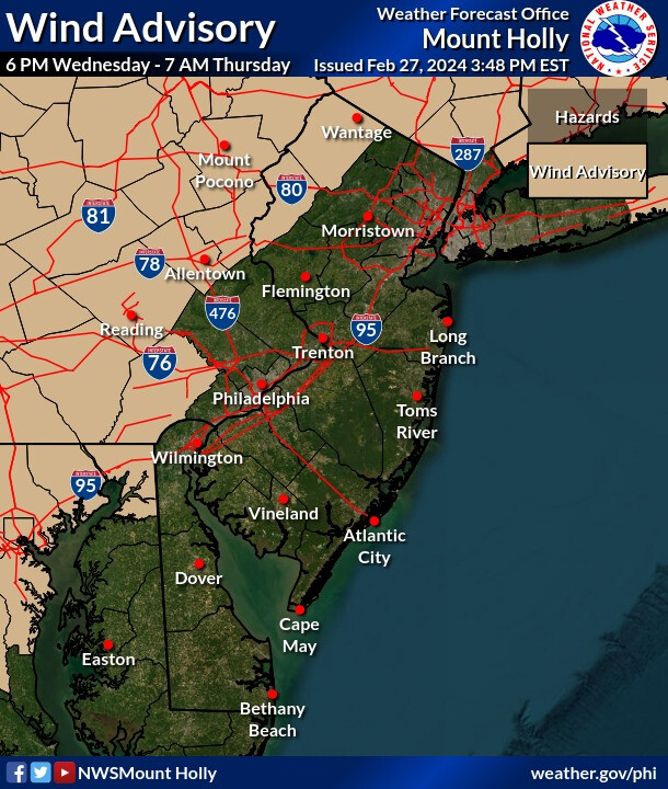
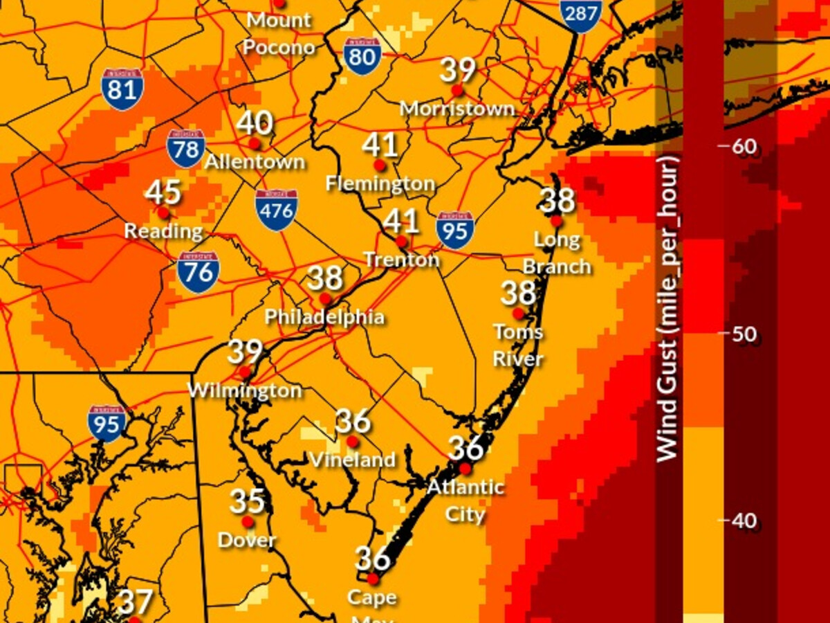
A Wind Advisory is now in effect for our northwestern counties, where slightly stronger winds are forecast (See attached map of the advisory and maximum wind gusts).
Locations affected: Our entire region. Timing: Heaviest rain with possible isolated thunderstorms later Wednesday afternoon and evening.
The strongest winds are mainly on Wednesday evening (about 6 to 11 PM), especially along and immediately behind the cold front. Impacts: Winds could be strong enough to down some trees and power lines, resulting in localized power outages. Heavy rain could result in locally brief minor flooding.